Beas Kund
Beas Kund is a lake-focused trek reached from the Solang side of Manali. This programme first reports at Rumsu, then follows the approach to Bakerthach and makes an out-and-back visit to Beas Kund before descending. The listed programme is 4 days / 3 nights; confirm the actual departure logistics before booking.
- Planned stage: Rumsu Base Camp
- Planned stage: Trek from Solang to Bakerthach
- Planned stage: Trek to Beas Kund. Descend to Bakerthach camp
- Planned stage: Descend to Solang Valley. Ride to Manali and depart from Manali by 5 PM
Updated by the Sapta Shikhar trek team
Trip overview
Beas Kund is a lake-focused trek reached from the Solang side of Manali. This programme first reports at Rumsu, then follows the approach to Bakerthach and makes an out-and-back visit to Beas Kund before descending. Reporting at Rumsu and starting the trail at Solang are separate steps. Allow for both the walking stages and the road transfers when planning your trip.
Beas Kund follows a 4 Days / 3 Nights schedule. The route stages below follow the scheduled package; weather and trail conditions can affect the final camp plan.
What’s included
- Two-person tent sharing
- Breakfast, lunch, snacks and dinner
- Forest and campsite permits
- First-aid equipment
- Trek leaders and camp support
- Tents and sleeping bags
- Gaiters
- Personal insurance listed in this package; confirm policy terms
- 5% GST included
What’s not included
- Travel and meals to/from the base camp
- Backpack porter/offloading charges
- Personal expenses
- Emergency expenses
Your day-by-day itinerary
Follow the route from your reporting point to the final descent. Camps and timings may change with mountain conditions.
01Day 1Rumsu Base Camp Alt. 6,500 feet
Begin with Rumsu Base Camp Alt. 6,500 feet. Check in at the confirmed reporting point, review the route with the team and make sure your day essentials are accessible. This stage is for joining the programme and preparing for the days ahead. Obtain the exact walk, meal and briefing times on arrival instead of assuming a schedule from another departure. An exact distance and duration have not been verified for this stage; obtain the departure's current plan from the team.
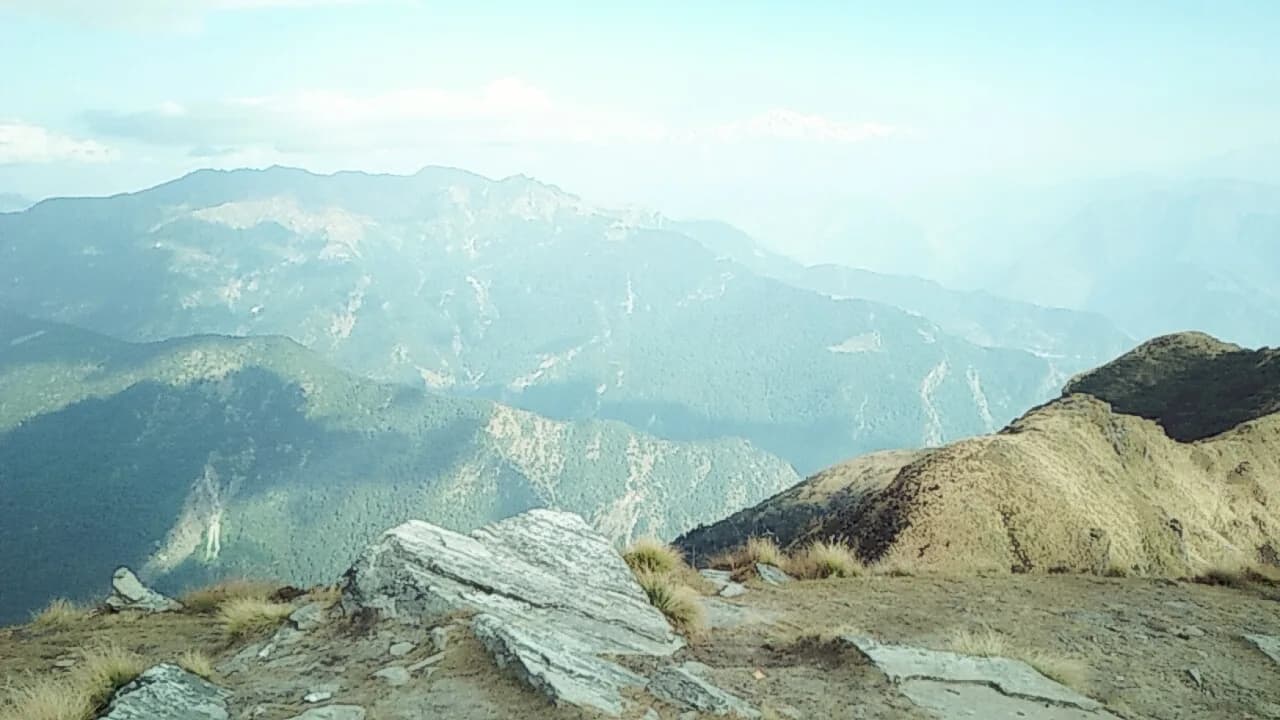
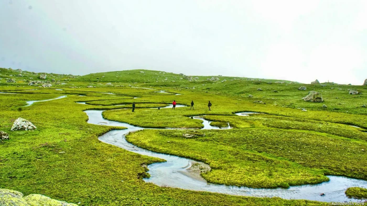
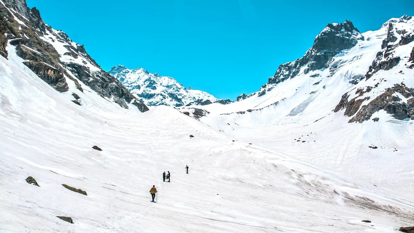
Views from the trek route
02Day 2Trek from Solang to Bakerthach
Continue along the listed route: Trek from Solang to Bakerthach. Keep your rain protection and warm layer accessible so a change in weather does not require unpacking your whole bag. Follow the group's rest stops and ask about the next refill opportunity before setting out. Campsite placement and the precise trail may change for safe access; use the morning briefing for the current plan. Approximate itinerary figures: 9800 feet · 5 hours. Times depend on conditions and group pace.
03Day 3Trek to Beas Kund. Descend to Bakerthach camp
Continue along the listed route: Trek to Beas Kund. Descend to Bakerthach camp. Treat this as a full mountain stage even if the listed distance looks short. Uneven ground and uphill sections can affect timing. Stay with the group and allow time to settle in at the next stop. Campsite placement and the precise trail may change for safe access; use the morning briefing for the current plan. Approximate itinerary figures: 12,500 feet · 7 hours. Times depend on conditions and group pace.
04Day 4Descend to Solang Valley. Ride to Manali and depart from Manali by 5 PM
The planned stage is Descend to Solang Valley. Ride to Manali and depart from Manali by 5 PM. Confirm where the group meets and how any walking and road sections connect. Keep your ID, water, warm layer and travel essentials accessible during the journey. Mountain-road delays can affect arrival times, so follow the team's update before making onward arrangements. Check the actual pickup or drop point and included services for this departure. An exact distance and duration have not been verified for this stage; obtain the departure's current plan from the team.
Route essentials
- Highest altitude
- 12,500 ft (3,810 m)
- Total route distance
- A complete walking-distance total has not been verified for this exact itinerary. Review the day-wise stages and ask the team for the departure's confirmed walking distance; road travel is separate.
- Best months
- This is a seasonal mountain programme. Request the route's current operating window and confirmed departure dates before booking; upper-route access depends on snow, weather and local permissions.
- Eligibility
- Participants should be comfortable with repeated uphill walks and carrying their day essentials. A prepared first-time trekker should discuss the longest stage and suitability with the team. Confirm the actual age limit and any required health documents for the departure.
- Accommodation
- Use the departure's confirmed accommodation plan for the arrival base and each overnight stop. The current inclusion list is shown separately; tent sharing, bedding and toilet arrangements should be checked before booking. Higher trail stays have simpler facilities than town accommodation.
- Meals
- Check the written departure package for included meals and the first and last meal served. Tell the team about allergies and dietary requirements before payment so they can confirm arrangements. Carry the personal snacks advised in the briefing; special diets should not be assumed to be available at every stop.
- Water, power & network
- Do not depend on continuous mobile reception, campsite sockets or shops along the mountain stages. Carry refillable bottles and a charged power bank, keep travel details offline and ask the leader about the day's drinking-water refill arrangements. Share the itinerary before leaving the reporting base.
Departure dates & prices
Choose an open batch to see the final payable amount and current availability.
Open for online booking
Checking online availability…
View published programme dates (0)
Getting to the trail
Reporting point
Current reporting location: Rumsu village, Himachal. The first listed stage is Rumsu Base Camp. Obtain the exact meeting pin, reporting time and whether the road pickup or transfer is included before arranging arrival.
By air
Kullu-Manali Airport at Bhuntar serves the Manali and Parvati Valley area. Confirm the onward road connection to the actual reporting point. Flights and mountain roads can be affected by weather, so allow an arrival buffer.
By road
Plan road travel to Rumsu village, Himachal using the confirmed departure instructions. The first stage is Rumsu Base Camp; this may involve a pickup before reaching the mountain base. Check the actual bus stop or pickup town, reserve the last connection in advance and allow for mountain-road delays.
Final transfer
The final listed stage is Descend to Solang Valley. Ride to Manali and depart from Manali by 5 PM. Confirm the actual drop point, estimated arrival window and whether the final transfer is included. Keep an onward-travel buffer rather than relying on a same-day tight connection.
Prepare for your trek
Prepare gradually with regular brisk walks, stairs or uphill trails and practice carrying your daypack. Include several consecutive walking days during preparation and wear the shoes you will use on the route. Review the longest stage with the team and arrive rested for the programme.
Route safety
Uneven trails, cold conditions and steep sections can make a short programme demanding. Stay with the group, follow the briefing and report difficulty early. The plan can change with weather, snow, river conditions or access; no pass or summit completion is guaranteed.
What to pack
- Trekking shoes worn in before departure
- Backpack with rain cover and waterproof inner bags
- Quick-drying walking clothes and spare socks
- Warm layers, insulated jacket and thermals
- Waterproof shell or poncho
- Sun hat, warm hat and gloves
- UV-protective sunglasses and sunscreen
- Headlamp with spare batteries
- Refillable water bottles
- Personal toiletries and small towel
- Prescribed medicines and blister-care supplies
- Power bank and essential travel details saved offline
- Reusable utensils if requested by the team
- Bag for carrying personal litter out
Trekking equipment included
- First-aid equipment
- Tents and sleeping bags
- Gaiters
Optional services & additional costs
- Travel and meals to/from the base camp
- Backpack porter/offloading charges
- Personal expenses
- Emergency expenses
- Two-person sharing upgrade: ₹750 per person
Documents & booking information
Every traveller uploads a photo ID while booking — masked Aadhaar, PAN card, passport, driving licence or voter ID. Our team checks it before the trek. Carry the original ID to the reporting point.
- Government-issued photo ID matching your booking name
- Booking confirmation and reporting instructions
- Confirm any ID-copy, medical certificate or participant consent requirement with the team
- For international travellers, confirm passport, visa and route-permit documents before booking
Cancellation & refunds
Obtain Sapta Shikhar's written cancellation and refund terms before payment. Confirm deadlines, deductions, date-change rules, unused services and the treatment of weather or access changes. No refund percentage or processing deadline has been verified for this listing.
Optional services
- Confirm whether backpack offloading is offered for this route
- Ask about shoe, pole, rainwear and headlamp rentals before arrival
- Obtain actual prices, deposits and return conditions for any rental
- Confirm pickup and return-transfer availability and charges
Beas Kund: frequently asked questions
What is the focus of Beas Kund?
Beas Kund is a lake-focused trek reached from the Solang side of Manali.
How long is this programme?
The listing shows 4 Days / 3 Nights. Check the day-wise schedule and confirm any reserve day or transport night before booking.
Where should I report?
The current reporting location is Rumsu village, Himachal. Ask for the exact meeting point, pickup arrangement and time for your departure.
How should I prepare for the route?
Prepare for consecutive walking days with uphill practice and a daypack. Break in your shoes and discuss the route's longer day with the team before booking.
Are snow, clear views or the upper objective guaranteed?
No. Weather, visibility and trail conditions can change the plan. The leader may shorten a stage or turn the group around.
Are personal rentals and transfers included?
Check the departure's written inclusions. Obtain availability, price and deposit details for any extra equipment, offloading or transfer before payment.
What are the cancellation terms?
Request Sapta Shikhar's written policy covering deadlines, deductions, date changes and weather-related changes. No refund percentage has been verified for this listing.
How difficult is the Beas Kund Trek?
The Beas Kund Trek is graded moderate. The highest point is about 12,500 ft (3,810 m). It suits fit beginners and people with some trekking experience; start cardio training (running, stairs, long walks) 6–8 weeks before.
What is the cost of the Beas Kund Trek?
₹7,000 per person (5% GST included) for 4 days / 3 nights from Rumsu village. It includes two-person tent sharing, breakfast, lunch, snacks and dinner, forest and campsite permits and first-aid equipment. Not included: travel and meals to/from the base camp, backpack porter/offloading charges and personal expenses.
How many days does the Beas Kund Trek take?
4 Days / 3 Nights, starting and ending at Rumsu village. See the day-by-day itinerary for each camp.
What is the maximum altitude of the Beas Kund Trek?
About 12,500 ft (3,810 m). Acclimatise by climbing gradually, drinking 3–4 litres of water a day and telling your trek leader about headache, nausea or breathlessness.
When is the best time to do the Beas Kund Trek?
This is a seasonal mountain programme. Request the route's current operating window and confirmed departure dates before booking; upper-route access depends on snow, weather and local permissions.
How do I reach Rumsu village for the Beas Kund Trek?
Current reporting location: Rumsu village, Himachal. The first listed stage is Rumsu Base Camp. Obtain the exact meeting pin, reporting time and whether the road pickup or transfer is included before arranging arrival.
Is the Beas Kund Trek safe for beginners?
It suits fit beginners and people with some trekking experience; start cardio training (running, stairs, long walks) 6–8 weeks before. Groups are limited to 30 people with trained trek leaders; you must be in good health and declare any medical condition before the trek.
How do I choose my first Himalayan trek?
Compare the maximum altitude, walking hours, daily climbs and season. Short forest routes such as Nag Tibba can be a starting point, but even a weekend trek needs fitness and weather preparation.
What equipment should I carry?
Carry broken-in trekking shoes, a backpack, warm layers, a waterproof shell, sun protection, a headlamp, refillable water bottles and personal medicines. Confirm which camp equipment and snow gear are included before departure.
How should I prepare physically?
Build walking endurance gradually with regular walks, stairs and strength work. Practise on uneven ground with your daypack. Match your preparation to the longest day of the chosen itinerary.
What should I confirm before booking?
Ask for dated availability, the final itinerary, group size, guide qualifications, inclusions, exclusions, transfer arrangements and cancellation terms in writing. A route guide does not guarantee an operating departure.
Can weather change the itinerary?
Yes. Snow, rain, road closures and permit restrictions can change camp locations, access and summit plans. Keep a travel buffer and accept the leader’s decision to turn back when conditions are unsuitable.
How do I reduce my impact on the trail?
Stay on established paths, carry litter back, avoid campfires on alpine ground and keep soap and waste out of streams. Respect wildlife, grazing areas and local customs.